

California Travel
The Golden Side of California: A Fall Road Trip Along Highway 395
Chase fall colors along California Highway 395 with our Eastern Sierra guide to Bishop Creek, Rock Creek, Convict Lake, Mammoth Lakes, June Lake, easy hikes and 2–5 day itineraries.

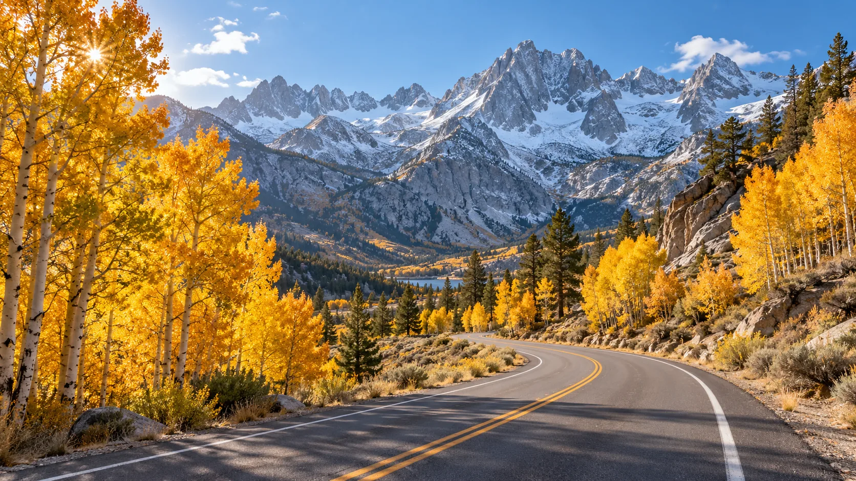
Fall road trip
North, into the gold.
When people talk about fall foliage, California doesn't always make the first sentence. It should.
Head north from Los Angeles on US Highway 395, and the Eastern Sierra puts on a show of its own: golden aspen groves, impossibly blue lakes, huge gray mountain walls, and small towns that practically ask you to stay for one more coffee. Some days, the best part of the trip is the place you planned to see. Other days, it's the unplanned stop ten minutes down the road.
This isn't a checklist of fifteen places to race through before sunset. It's a guide to the stops worth lingering at, the hikes you can actually fit into a vacation, and the best ways to catch the color without spending your whole weekend behind the wheel.
The short version: Give yourself four days and three nights for a relaxed first trip, or three days and two nights if you have a long weekend. The season generally runs from mid-to-late September into October, with higher elevations changing first. Check current foliage reports before picking your exact route.
The route: follow 395, with a few very worthwhile detours
Coming from Los Angeles or Orange County, think of the trip in this order:
Bishop → Bishop Creek Canyon → Rock Creek → Convict Lake → Mammoth Lakes → June Lake Loop → Lee Vining / Mono Lake
With a fifth day, you can keep going toward Conway Summit and Bridgeport. Bishop Creek, Rock Creek, and June Lake Loop are scenic side trips off US 395—not stops you see just by staying on the main highway.
Here's the trick: don't judge the itinerary by mileage alone. You may only drive for an hour and still spend half a day wandering around a lake and taking photos. Build in that time. It's kind of the point.
When do the leaves turn?
There's no single peak-color weekend for the whole highway. The Eastern Sierra covers a wide range of elevations, so the show usually starts high and moves gradually down the canyons.
| Rough seasonal window | Areas to watch |
|---|---|
| Mid-to-late September | Higher Bishop Creek and Rock Creek, Virginia Lakes |
| Late September–early October | Different elevations in Bishop Creek, Rock Creek, parts of Mammoth |
| Early-to-mid October | Convict Lake, June Lake Loop, Lundy Canyon, Lee Vining area |
| Mid-to-late October | Some lower valleys and farther-north areas, weather permitting |
These are typical patterns, not guaranteed 2026 peak dates. Windstorms, a cold snap, or early snow can change the schedule quickly. Before you go, check:
- California Fall Color for photos, local reports, and a color map. This is the most useful place to start.
- Mono County's Fall Color Report for the June Lake, Rock Creek, Lundy, and Bridgeport areas.
- Visit Mammoth's Fall Color Guide for lake-by-lake updates around Mammoth.
Check the date the photo was taken, not just when a post went up. A gorgeous shot from last October can't tell you what will be golden this Friday.
Stop 1: Bishop Creek Canyon — where the color starts to glow
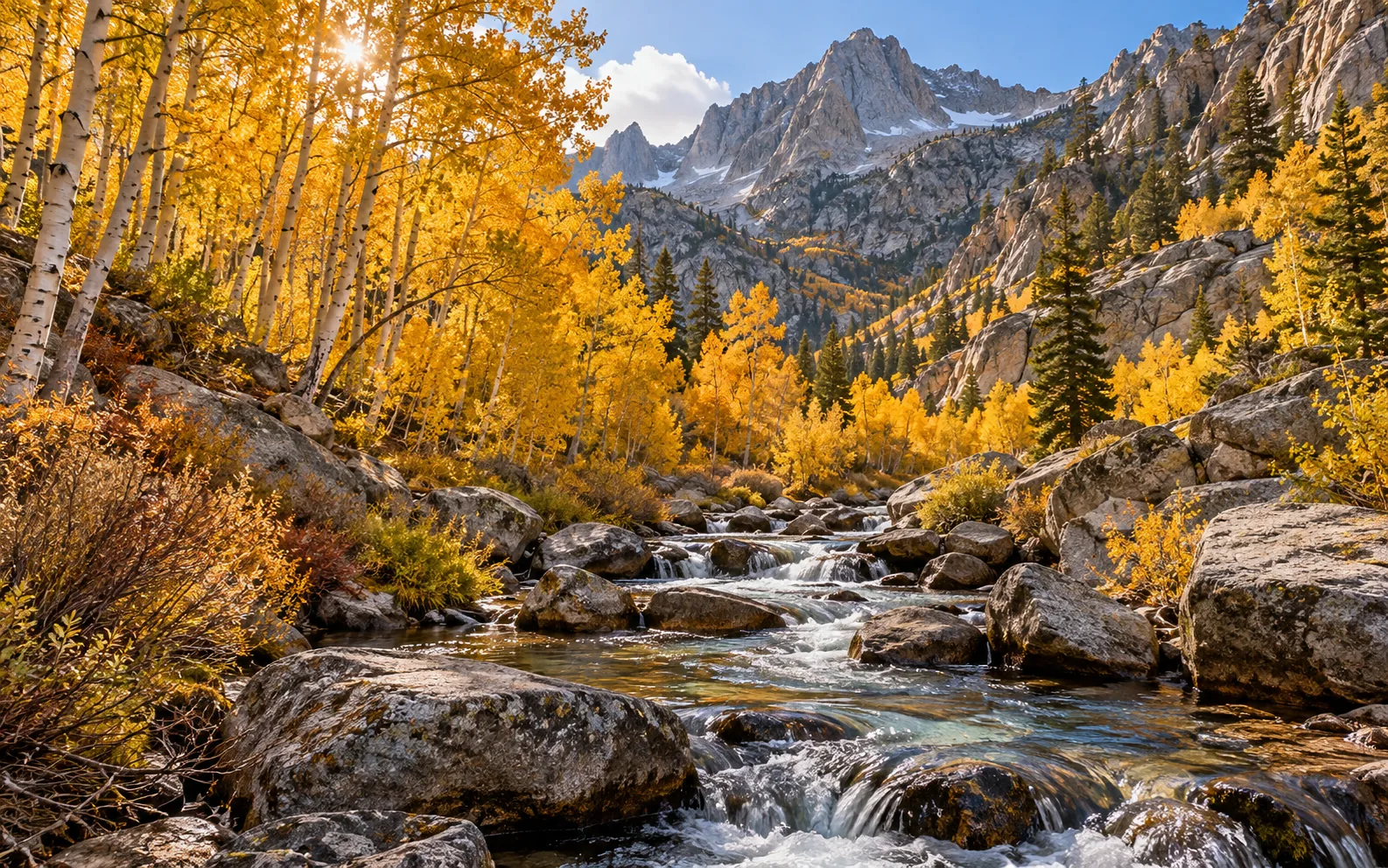
If you're traveling in late September, Bishop Creek is a great place to start looking. From Bishop, head west on CA-168. As the road climbs into the mountains, the scenery shifts from open valley to aspen-lined canyon. On a sunny morning, even an ordinary roadside grove can be ridiculously beautiful.
There are several worthwhile stops here, so don't think of Bishop Creek as one pin on a map.
Lake Sabrina: blue water, bright trees, big mountains
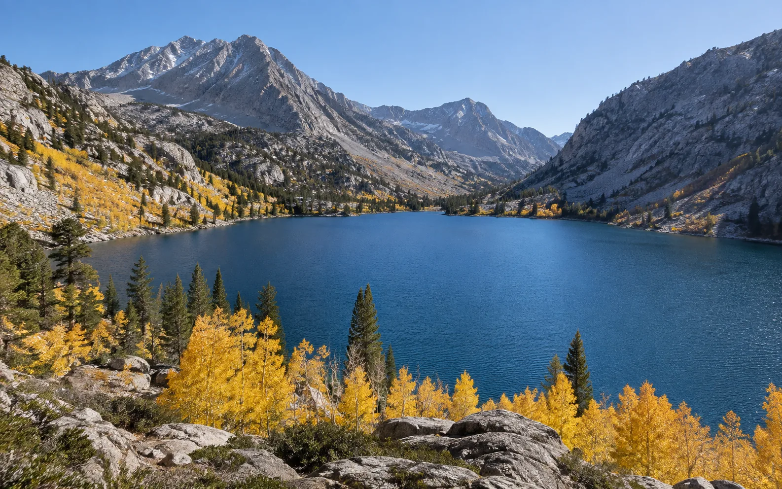
This is the kind of lake scene that makes you stop talking for a minute. Come for the layers: water, aspens, and rugged peaks beyond. It's lovely without committing to a long hike, although water levels and reflections won't always match the postcard version.
Best for: A scenic morning, lakeside photos, and a relaxed stop.
South Lake: enjoy the drive, not just the destination
The road toward South Lake has its own highlights. Watch for color around Surveyor's Meadow, near Parchers Resort, and along the creek corridor. When you find a legal pullout, stop and take it in. You don't need a named trail for every beautiful view.
Best for: People who want a full morning of fall scenery without a full day of hiking.
What about North Lake?
North Lake is famous for its small reflective lake and aspen backdrop. There's one important catch for rental-car travelers: North Lake Road is narrow, steep, and partly unpaved. If your rental restricts unpaved-road or off-road driving, don't drive it simply because a photo guide tells you to go. Stick to compliant paved-road viewpoints in the canyon or arrange a permitted alternative way to visit.
2026 access note: Construction at Lake Sabrina's dam has closed some dam-top walkway access. Check the latest local advisories rather than assuming an older trail description still applies.
Stop 2: Rock Creek — a canyon made for slow mornings
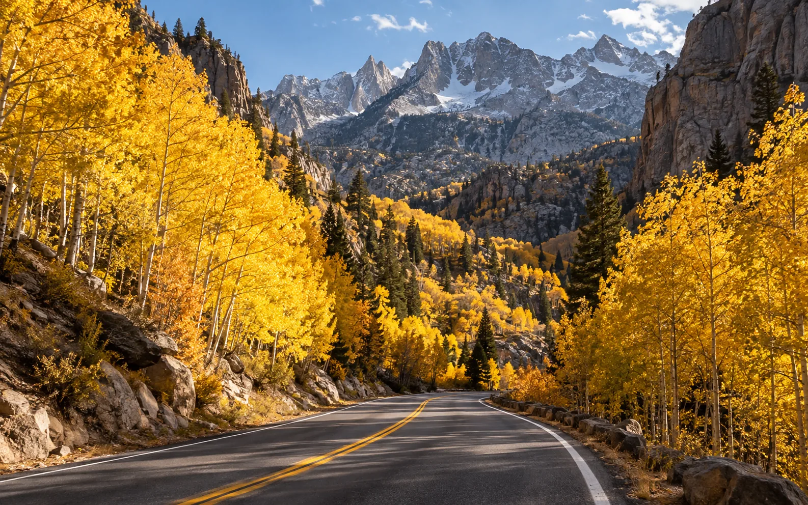
Continue north of Bishop and turn into Rock Creek Canyon. The road climbs through changing layers of color, with creeks, trees, and mountain views along the way. On a good foliage day, the drive itself can be the main event.
For an easy visit, aim toward the Rock Creek Lake area, take your time, and use designated parking when you want to step out. If you're in the mood for a longer walk, there's a famous trail farther up the canyon.
Trail option: Little Lakes Valley
Starting at Mosquito Flat Trailhead, Little Lakes Valley delivers alpine lakes beneath enormous peaks. Go a short way and turn around, or continue toward farther lakes if you have the time, energy, and appropriate conditions.
There's a reason not to underestimate it: the trail starts around 10,000 feet above sea level. An easy-looking walk can feel much harder at that elevation. Go slowly, drink water, and turn back if you develop headache, dizziness, or nausea. Snow and ice can arrive early in the season.
Also, the trail is more of an alpine-lake outing than a nonstop tunnel of gold. Depending on timing, you may see more concentrated fall color along Rock Creek Road below.
Stop 3: Convict Lake — big payoff, little effort
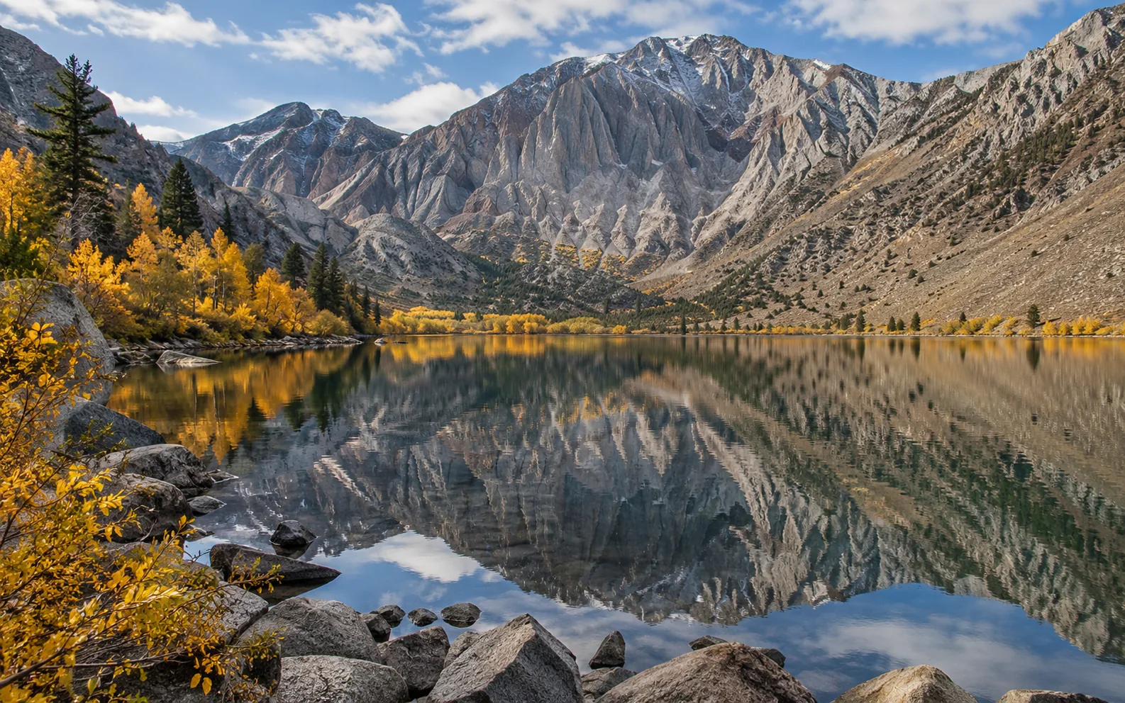
If you only want to fit one easy lakeside walk into your trip, Convict Lake makes a strong case. It's close to the main highway, the mountain backdrop is huge, and fall adds a bright border of gold around the water.
Try arriving early if you're hoping for a calm reflection. Or go later in the day to catch the light warming up the rock faces. Both are good excuses to stay longer than you planned.
Trail option: Convict Lake Loop
- Roughly 2–2.5 miles around the lake, depending on where your map starts measuring.
- Allow 1–2 hours, longer if your camera roll gets out of hand.
- Parts of the east shore are paved and easy to access, but the full loop includes narrow, rocky sections. Don't assume the entire circuit is accessible or stroller-friendly.
Not in the mood for a loop? Walk part of the shoreline, find a good view, and call it a very successful stop.
Stop 4: Mammoth Lakes — stay a little while
Mammoth isn't just a ski-town winter destination. In fall, it's a comfortable base: lakes by day, dinner in town, and an easier start the next morning. It's also a practical place to regroup, pick up supplies, and plan your next charge.
For a relaxed afternoon, visit the Mammoth Lakes Basin and explore the areas around Twin Lakes, Lake Mary, or Lake George, depending on road access and current color.
Trail option: Heart Lake
The Heart Lake hike from the Coldwater area is approximately 2.25 miles round-trip, generally considered easy to moderate. It's a nice way to add a proper walk without turning your vacation into a full-day expedition.
Roads and trails up here are seasonal. Check the weather, start with enough daylight, and don't count on a high-elevation trail staying snow-free just because it's still fall on the calendar.
Stop 5: June Lake Loop — the scenic drive you shouldn't rush
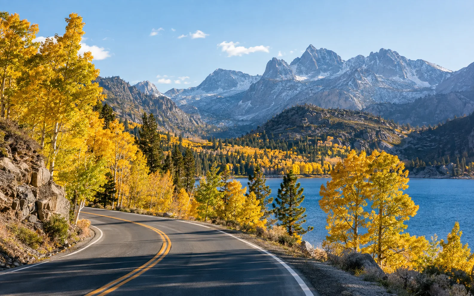
The June Lake Loop (CA-158) is the part of the trip where “just one more photo” becomes your official itinerary.
This roughly 14-mile scenic drive links four lakes: June, Gull, Silver, and Grant. Along the way, you'll get charming town moments, water framed by autumn leaves, and winding roads that make it hard to believe this is all within a few hours of Southern California.
Start near June Lake village, grab a coffee, wander to the shore, then continue toward Silver Lake. Pick one spot to sit with lunch instead of trying to see every corner in a hurry. A half-day is a much better fit than a quick drive-through.
One practical detail: the stretch between Silver Lake and Grant Lake has narrow sections and wildlife crossings. Use designated parking, never stop in a travel lane or blind curve, and resist the temptation to pull onto a soft shoulder for that perfect photo.
Stop 6: Lundy Lake and Mono Lake — two completely different landscapes
Head farther north and the landscapes change again. Lundy Lake is quiet and layered with mountain color. Deeper in the canyon are creeks, waterfalls, and a well-known fall hike.
The catch: the usual Lundy Canyon Trail access continues beyond the lake on an unpaved road. If your rental agreement doesn't allow that road, stay at compliant paved-road viewpoints near Lundy Lake. Only plan the full hike if you've worked out permitted transportation and confirmed current access.
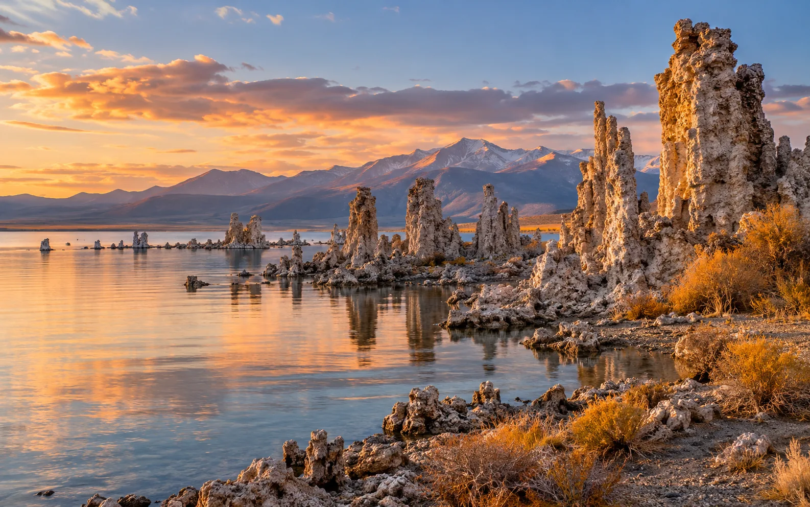
Then comes Lee Vining and Mono Lake. It's not your classic golden-aspen stop, which is exactly why it belongs on the trip. The enormous saline lake and strange-looking tufa towers give the day a totally different ending.
If you're planning to visit South Tufa, confirm the access-road condition and your rental's restrictions first. If it's not suitable, the Old Marina area near US 395 and the Mono Basin Visitor Center are other ways to appreciate the lake. Don't rely on an older itinerary that sends you to the Mono Lake County Park boardwalk; a closure notice was still in place in September 2026.
How many days do you actually need?
| Time available | A realistic route | What to expect |
|---|---|---|
| 2 days / 1 night | Bishop → Bishop Creek → one of Rock Creek or Convict Lake → home | A quick fall escape with plenty of driving; choose a few stops and do them well |
| 3 days / 2 nights | Day 1 Bishop; Day 2 Bishop Creek + Rock Creek; Day 3 Convict Lake + selected Mammoth or June Lake stop, then home | Better for a long weekend and one easy hike |
| 4 days / 3 nights | Day 1 Bishop; Day 2 Bishop Creek + Rock Creek; Day 3 Convict Lake + Mammoth; Day 4 June Lake Loop and return | A comfortable introduction, though the final southbound drive is still long |
| 5 days / 4 nights | Add a day for Lundy, Mono Lake, or the farther-north Bridgeport / Conway Summit area | More room for sunrise photos, weather changes, and unplanned stops |
If you're coming from LA or Orange County, factor in the drive home before stacking your final day with northern stops. Mono Lake on the morning of your return trip is much easier with an extra night than with a fixed dinner plan back in LA.
Where should you stay?
Bishop — for early-season color and canyon access. A convenient base for Bishop Creek, with food and supplies in town. One night works; two nights make sense if you want to photograph several different elevations.
Mammoth Lakes — for a flexible first trip. Handy for Convict Lake, the Mammoth Lakes Basin, Rock Creek, and June Lake. You'll have a range of hotels, condos, and vacation rentals to choose from. Two nights here can simplify the trip.
June Lake — for a quieter mountain-town feel. Look for a small inn or cabin if waking up close to the water is part of the appeal. Popular fall weekends can fill up, so book early.
Lee Vining or Bridgeport — for the northern stretch. Better if you're continuing to Lundy, Mono Lake, or Conway Summit instead of doubling back to Mammoth every evening. Expect fewer lodging options and some seasonal operating hours.
You don't need a different hotel every night. One night in Bishop and two in Mammoth is an easy structure for a three-night trip; add a night farther north if you want to keep exploring.
Which hike fits your trip?
| Your mood | Try this | Plan for |
|---|---|---|
| Mostly photos, not a hike | Lake Sabrina / South Lake accessible viewpoints; June Lake shoreline | Short walks and time to sit by the water |
| Easy lakeside stroll | Convict Lake Loop | About 2–2.5 miles for the full loop |
| A little trail time | Heart Lake | About 2.25 miles round-trip |
| Alpine lakes and peaks | Little Lakes Valley | Flexible out-and-back from Mosquito Flat; high altitude |
| Deeper canyon adventure | Lundy Canyon Trail | Only with compliant transportation to the trailhead and verified access |
One solid hike is plenty on a day with several scenic stops. At 9,000–10,000 feet, even a short route may take more energy than you'd expect.
A few tips that make the whole trip better
Dress for two seasons. It might feel warm in Bishop and genuinely cold beside a high mountain lake. Layers, a fleece, and a wind-blocking jacket are your friends.
Check roads before trusting an ETA. US 395, CA-168, CA-158, and seasonal access roads can be affected by construction or early snow. Use Caltrans QuickMap and Caltrans Highway Conditions, then check local trail alerts.
Don't take a rental down a dirt road for a photo. This guide prioritizes sights reached by paved roads. Some well-known viewpoints and trailheads have narrow or unpaved access. Movia rentals prohibit off-road driving and must be used within the road restrictions in the rental agreement. If you're unsure, pick a compliant paved-road stop instead.
Plan EV charging before you need it. Climbs, cold temperatures, detours, and heating can affect range. Check available chargers and projected arrival battery in the vehicle's navigation. Charging at your hotel, when available, makes the next morning easier.
Download offline maps and bring water. Cell service can disappear in the canyons. Share your hiking plan with someone and turn around if weather or altitude symptoms become a problem.
Protect the places you came to see. Park only where allowed, stay on trails, keep tires off fragile aspen roots, never carve into bark, and carry out your trash.
FSD is assistance, not a sightseeing mode. With Full Self-Driving (Supervised), you're still responsible for the drive. Stay attentive and take over when needed, especially around curves, construction, bad weather, and roadside activity. Want to take a photo? Park safely first.
September 2026 foliage and road update
This snapshot is current to the September 23, 2026 edit.
- A September 17 California Fall Color report, using photos taken September 16, described near-peak pockets around Lake Sabrina and Surveyor's Meadow in Bishop Creek Canyon. That does not mean the entire 395 corridor is peaking.
- The mid-September reports showed emerging patches around Rock Creek, while June Lake Loop and Convict Lake were still early. Re-check the newest reports before committing to a particular lake.
- Road alert: Caltrans' September 23, 11:50 a.m. US 395 notice reported a southbound closure near Independence, from Mazourka Canyon Road to Manzanar, for construction through 5 p.m. October 30, 2026. Check the current notice and official detour before planning your southbound return. This dated snapshot is not a live traffic feed.
The best part? You don't have to see everything.
Maybe you catch peak color at Bishop Creek. Maybe you find a quiet spot at Convict Lake. Maybe you stop for coffee in June Lake and decide the next hour can wait.
That's what makes Highway 395 such a good fall road trip: the views are spectacular, but there's no need to rush through them. Bring a warm layer, your favorite playlist, and a little flexibility. Then head north.
More Life Between Destinations.
Plan with current information: California Fall Color · Mono County Fall Color Report · Visit Mammoth Fall Color Guide · Caltrans Road Conditions · Mono Lake State Natural Reserve